

Research progress in earthquake infrared background field and brightness temperature background field foundation of the demonstration areas
-
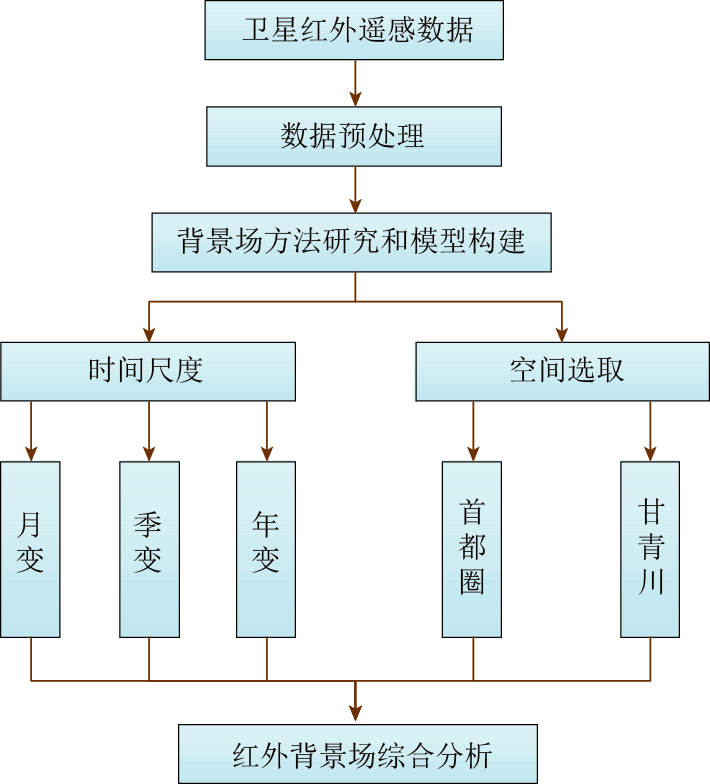
摘要: 本文综合阐述了国内外红外背景场的研究进展,进而基于2010—2013年FY-2E卫星热红外亮温数据构建了首都圈和甘青川交界地区的亮温背景场,并对其时空演化特征予以分析. 研究结果表明,红外亮温背景场时间上主要受季节变化影响,空间上主要受地形影响,为地震热异常的判定和识别提供了研究基础和依据.Abstract: The construction and analysis of thermal infrared background field can effectively improve the recognition of thermal anomaly before an earthquake. This paper comprehensively discusses the research progress of thermal infrared background field,and then uses China’s FY-2E satellite thermal infrared brightness temperature (TBB) data of 2010—2013 to construct the TBB background field of the Capital region and Gansu-Sichuan-Qinghai border region,and the spatio-temporal evolution characteristics of TBB background fields for the two regions are analyzed. The results show that,TBB background field is mainly affected by seasonal variation in time and by terrain in space. The results provide research foundation and basis for the judgement and identification of thermal anomaly for earthquakes.
-
-
![]()
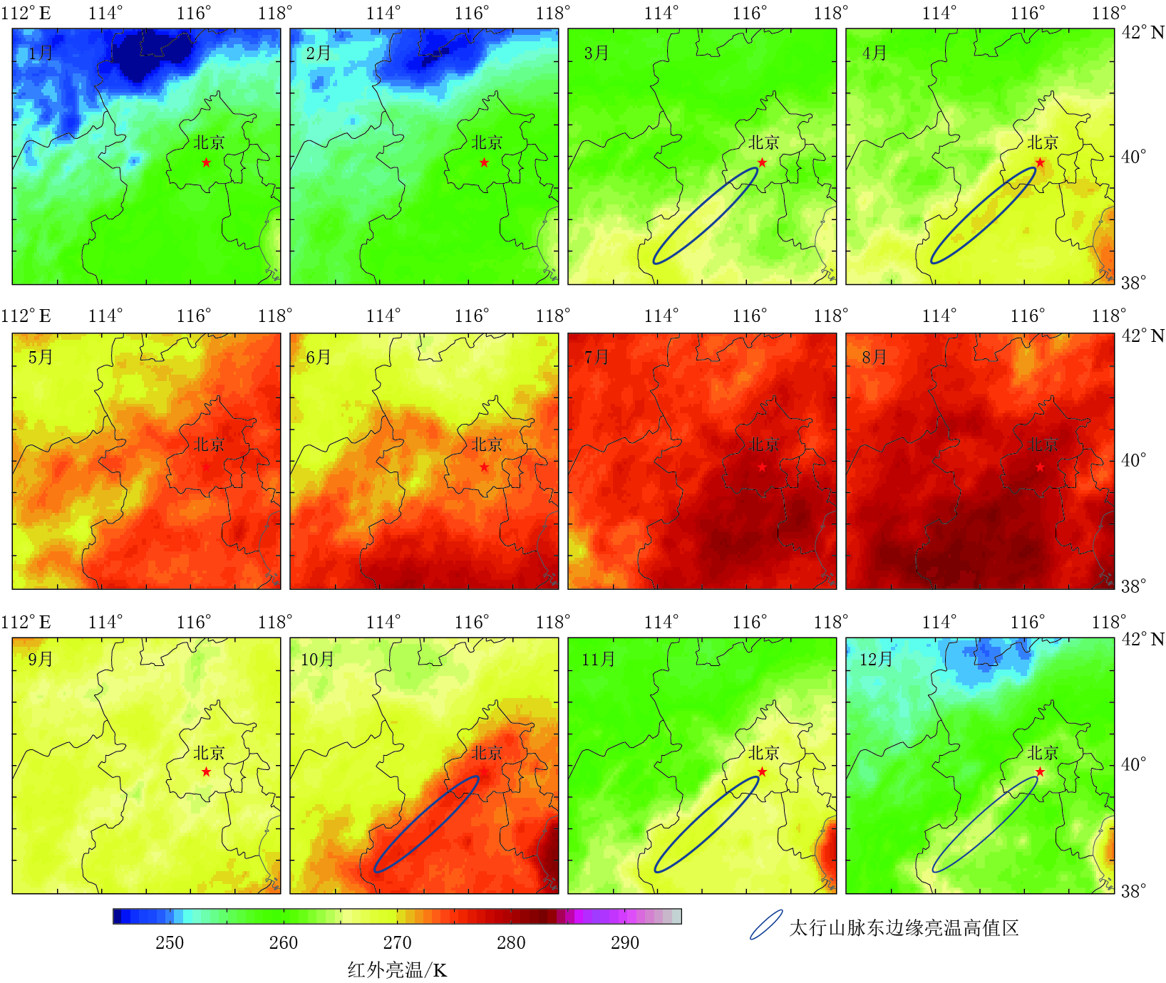
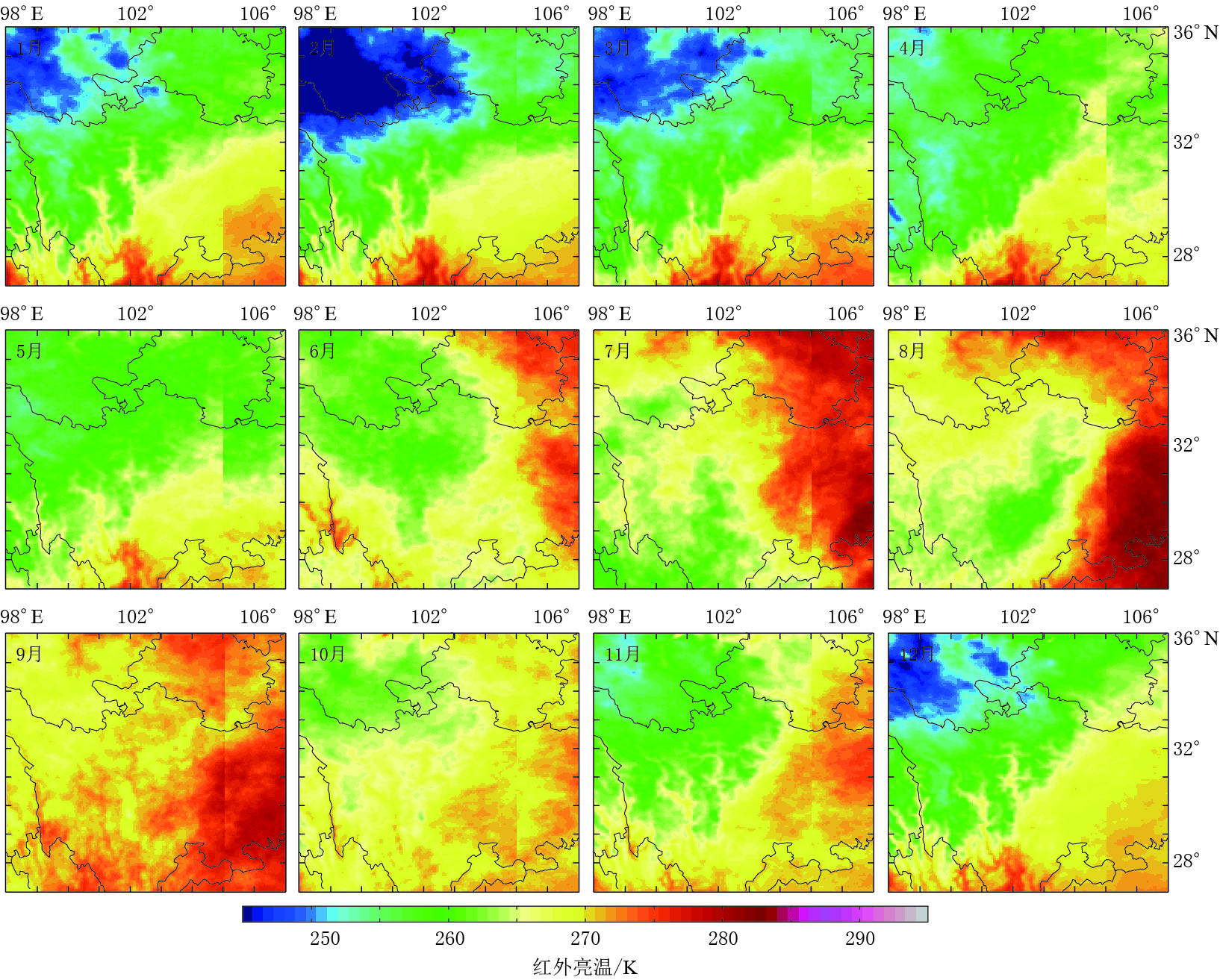
图 3 2013年首都圈红外亮温月背景场
Figure 3. Monthly background field of the brightness temperature of the Capital circle region in 2013
![]()
图 4 首都圈2010—2013年亮温季背景场
Figure 4. The season background field of brightness temperature in the Capital circle region in 2010—2013
![]()
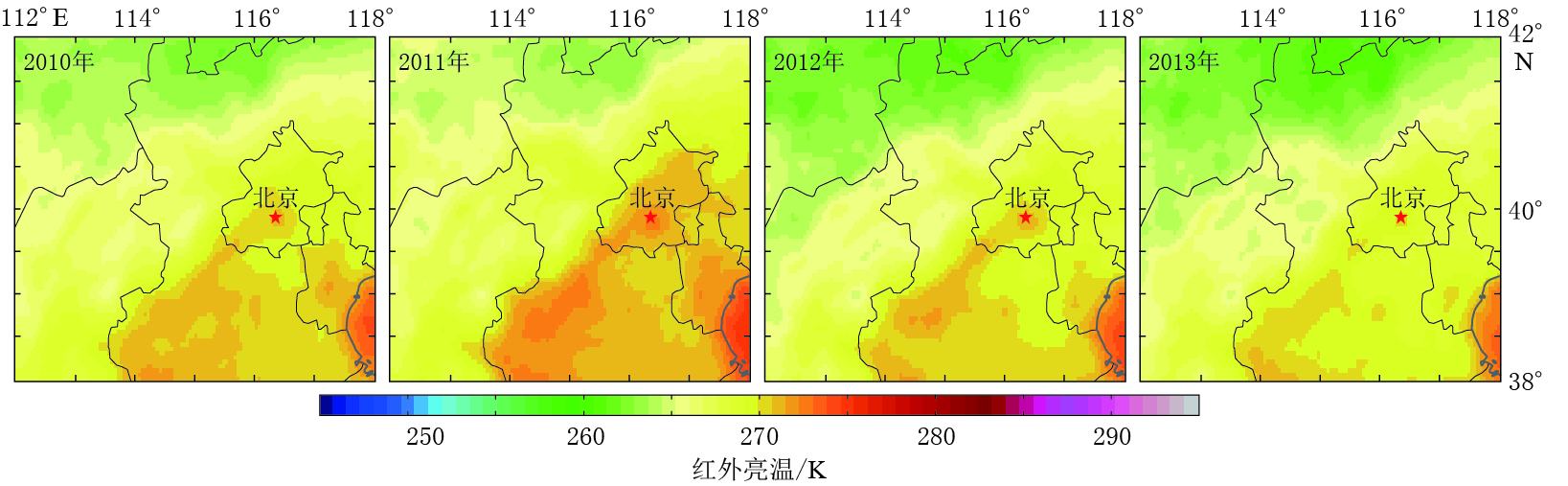
图 5 2010—2013年首都圈历年亮温年背景场
Figure 5. The annual background field of brightness temperature in the Capital circle region in 2010—2013
![]()
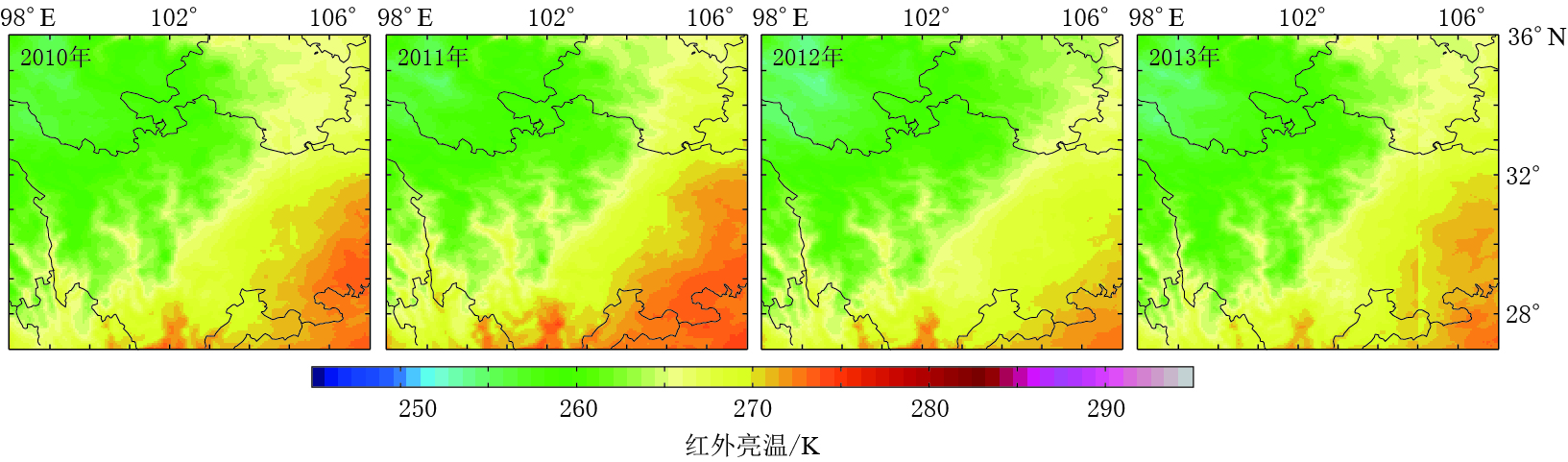
图 7 2010—2013年甘青川交界亮温年背景场
Figure 7. The annual background field of brightness temperature in Gansu-Qinghai-Sichuan border region in 2010—2013
-
陈顺云. 2006. 提取现今构造活动信息的定量热红外遥感方法研究[D]. 北京: 中国地震局地质研究所: 16-24. Chen S Y. 2006. A Study on the Quantitative Thermal Infrared Remote Sensing Method for Extracting Information of Current Tectonic Activity[D]. Beijing: Institute of Geology, China Earthquake Administration: 16-24 (in Chinese).
马晓静. 2008. 中国大陆地震卫星热红外异常的亮温背景场研究[D]. 北京: 中国地震局地质研究所: 18-30. Ma X J. 2008. A Study on the Brightness Temperature Background Field of Satellite Thermal Infrared Anomalies of Earthquakes in the China Mainland[D]. Beijing: Institute of Geology, China Earthquake Administration: 18-30 (in Chinese).
温少妍. 2011. 地震构造区红外亮温背景场建立及异常提取方法研究[D]. 青岛: 中国石油大学(华东): 29-44. Wen S Y. 2011. A Study on the Brightness Temperature Background Field Foundation and the Method for Extracting Anomalies of Thermal Infrared in Seismotectonic Area[D]. Qingdao: China University of Petroleum (East China): 29-44 (in Chinese).
闫丽莉. 2012. 卫星红外与微波亮温对比研究及在地震监测中的初步应用[D]. 北京: 中国地震局地质研究所: 19-27. Yan L L. 2012. Comparison of Brightness Temperature Images From Satellite Remote Sensing of Infrared and Microwave and the Preliminary Application to Earthquake Monitoring[D]. Beijing: Institute of Geology, China Earthquake Administration: 19-27 (in Chinese).
 下载:
下载:


计量
- 文章访问数: 526
- HTML全文浏览量: 248
- PDF下载量: 18
